Showing posts with label Mappy Monday. Show all posts

Wednesday, May 6, 2020

Getting From HERE to THERE In Quarantine Time

After seven weeks of self-imposed quarantine and state mandated "shelter-in-place" during the Spring of 2020, I had put a big dent in my pile of research documents that had needed to be filed. I was actually studying, documenting, labeling, and filing almost every other day. But then one day, I came across a land record that had been in my pile for almost three years. I was ready to do a "Genealogy Happy Dance" because that record sparked my curiosity, making me want to learn more about it, and, admittedly, letting me leave filing for a while without feeling any guilt.

The document was a land warrant conveying 236 acres in Green(e) County, Tennessee to Joseph Bogle, my husband's fourth GreatGrandfather. Were my husband still alive, I knew this would have been some research he would have wanted to help me explore. And explore I did.


"Ancestry.com. North Carolina and Tennessee, Early Land Records, 1753-1931"


Step 1: The first thing I needed to do was to transcribe that document written over 230 years ago. I had found the record in Ancestry's database of "North Carolina and Tennessee, Early Land Records, 1753-1931", but the transcription made the record so much easier to read. For convenience, I also photocopied my transcription onto the source citation I had downloaded with the record.

Step 2: Although I no longer lived in the area, I still had a real interest in learning more about where the land belonging to Joseph Bogle was actually located. I wanted to see if I could find the 236 acre plot on a topographic map of Greene County, Tennessee (today the name of the county is spelled with that final "e").

Google Maps made it quick to find Little Chucky Creek in Greene County, but locating Delaney Creek took some time. The USGS (United States Geological Survey) now had free map downloads available on their website using the the TNM download. It was relatively easy to follow the course of Little Chuckey Creek on the topographic map of Greene County. After a few minutes of sizing and resizing portions of the sectional maps for Greeneville and Mosheim (towns in Greene County), I found "Little Chuckey at the mouth of Delaney Creek" or Little Chucky Creek and Dulaney Branch as they are labeled on the current topographic map.


The red diamond indicates where Dulaney Branch runs into the Little Chucky Creek


Step 3: The warrant was for 236 acres, but knowing the hills, valleys, creeks, and rivers of this area, I had to wonder what that plat of land might look like. I knew there was platting software available to purchase, but I was hoping to find a free way to plat the land warrant. Online I found two great articles that explained just how to do that. Both articles are now printed and in my "Land Records" research folder.

Mark Hamilton's The Walden Effect blog had a post on "How to Map Property Boundaries From a Deed". (1) I especially appreciated the photos of his platting process. Hamilton also included a diagram of a surveyor's compass, an instrument that turned out to be much easier to use than the old school protractor I found in my desk. I followed his suggestion to photocopy the compass and was finally able to get my final plat line to join back to the starting point of my property drawing. Hurrah!

The second helpful article "Land Platting Made Easy" was written by Kimberly Powell.(2) It featured a step by step process for platting as well as helpful descriptions and examples. Basically I followed Powell's list of steps and referred to Hamilton's post for visuals.

Powell's article called for transcribing the deed or land warrant and creating a call list before ever attempting to plat the deed. Transcribing the land warrant I had found online made it much easier to read and to double check my directions. The call list is simply a list of the directions that were taken in the survey, things like:
  • Beginning at Gamel's at a dogwood  (Starting point of the survey was apparently property belonging to a Mr. Gamel, at the corner where there was a dogwood tree)
  • On a line South 47 East (From the dogwood tree, go on a course of SE 47 degrees)
  • One hundred and ten poles to a hill to a poplar (Go on this SE course for 110 poles or 1815.0 feet as 1 pole equals 16.5 feet to the poplar tree on the hill)
Having the list also made it simple to check off each step as I had marked it on my graph paper which had been a free download from PrintFreeGraphPaper.com.


My transcription and Calls List for the land warrant.


After switching from the school protractor to the surveyor's compass, I finally came up with a plat that was a visual for the information presented in the land warrant.  


My plat drawing, made with the help of a paper surveyor's compass.


Step 4: The final step was to compare my drawing with the topographic map I had found. Would my drawing fit? Unfortunately I had not made my land plat on the same scale as the downloaded USGS map so I had to do so thinking here. Going back to the map segment I downloaded in Step 2, I noticed that it was shown with the scale of 2 cm equals 1000 feet. With that basic information I copied the photo of my plat drawing and resized it on a Word document until that long East to West line from a stake to the poplar was 5 1/2 cm / 2 1/8" to more accurately represent the 165 poles / 2722.5 ft indicated in the land warrant.

After cutting out the resized shape, I tried putting it onto the larger 2 cm = 1000 feet map, hoping to find a place where Joseph Bogel's property seemed to fit. No matter where I placed the plat shape, I wasn't able to find a spot near the juncture of Little Church Creek and Delaney Branch that had a hill where the shape indicated one should be. The exact location will need to be determined by someone who actually knows what s/he is doing.


Plat template and the map


Spending this time looking at the deed, drawing the boundary lines for the property, and trying to locate the area was a welcomed break from filing. I also leaned about some new resources that I expect to use in the future.

And, of course, I ended up with more questions. After all, Joseph Bogle was living about 50 miles away in Blount County at the time the land warrant was written, living there up to his death in 1790. Did Joseph Bogle ever set foot on this property? Was the land meant to be payment to him for his service in the Revolutionary War? Did he sell it? Did he not act on the land warrant such that it just went to someone else? More questions for another day. And perhaps I will find another treasure to examine when I return to filing.

.....................

(1) Hamilton, Mark, "How to map property boundaries from a deed". The Walden Effect. accessed 4 Apr 2020. http://www.waldeneffect.org/blog/How_to_map_property_boundaries_from_a_deed/.
(2) Powell, Kimberly. "Land Platting Made Easy." ThoughtCo, Feb. 11, 2020, thoughtco.com/land-platting-made-easy-1422116.

Monday, April 13, 2015

Mappy Monday : Here Comes the Syversen Family, part 3

The Syversen Family
created using Wordle.net


Between 1870 and 1900, a number of members of the Syversen family immigrated from Lesja, Oppland, Norway, and settled in the United States. Following their move, family members usually took on a variety of surnames. The primary ones found through US and state census records or engraved on cemetery markers are shown above.

By 1900, the family members were scattered across the midwest and were known by a number of different surnames. Yet, they were still family. Below is a brief look at the Syversen family after they came to the United States.

Patriarch Syver Hansen kept the surname of Hansen. A few years after immigrating, he died in Jackson County, Wisconsin.

His oldest daughter Anne Syversdatter and her husband Haldor Ericksen remained in Norway, but all five of their sons immigrated to the US in the 1870s. The brothers at times lived near each other but eventually were scattered across the country.  Son Elias moved to Wabaunsee County, Kansas and was known as Elias Holvorson for many years. Their second son Syver moved to Umatilla County, Oregon. Lars went by the name of Louis Halverson after his move to Garvin County, Oklahoma. Their fourth son Mathias. known as Mat Halvorsen, lived in Morrow County, Oregon. Ole, their youngest son, ended up in California. Three versions of a surname, four different states, and that is just one part of the Syversen family.

Hans Syversen, the son whose immigration started this series of posts, eventually lived in Day County, South Dakota, and took the surname of Belle. His sons Hans, Ole, Anton, and Otto continued to reside in South Dakota but used the Belden surname, Belden being the name of the farm area where the family has resided in Norway. Anton was later known as Anthony Belden while his brother Otto was sometimes referred to as Oscar Belden.

Another daughter, Ronaug Syversdatter, married in Norway and later immigrated to the Trempealeau, Wisconsin area with her husband, Syver Johannansen.

Guro Syversdatter seems to have been the first family member to immigrate, coming to the Chicago area around 1870. After her marriage to Erick Pederson, the family lived in Jackson County, Wisconsin. Through the years, several family members would stay with Guro and Erick after they first arrived in the US.

The second son, Syver Syversen also lived in the Jackson County, Wisconsin area. Syver, however, was known as Siver Siem, Siem being the name of another farming area in Norway.

My Great Grandmother, Kari Syversdatter, immigrated to the US before 1881 and married my Geat Grandmother, Peter Petersen Myren, They homesteaded in North Dakota, and a descendant of theirs still owns the family farm. Two of Kari and Peter's daughters preferred to use the surname of Myron while the rest of their siblings, as well as the parents, chose to use the name Myren.


It has been interesting to follow the various paths taken by members of the Syversen family. As shown on the map above, by 1900 the siblings and cousins were scattered across the country. Each seemed to have a surname preference, and although many were farmers, they also followed a variety of career paths. My research in following the family has also led me to contacts with other family members living across the US today.

I chose to write this post without my usual citations, but trust me, they exist. Feel free to contact me if you are interested in the sources used for the information presented here.

A final thank you to Thomas MacEntee. His Genealogy Do-Over encouraged me to be more systematic in my research and in recording the information I located. Without these tweaks to my methodology, I probably never would have been able to write this post.

Now, I think I'll take a look at some of those Bright Shiny Objects I came across in this journey.

Monday, February 24, 2014

Mappy Monday - Keeping Up With the Willbanks Family


Places associated with the Willbanks family.
A - Cherokee County, GA; B - Texas; C - Arkansas; D - Marshall County, AL;
E - Marion County, AR; F - Pontiac, MO
(map created using Google Maps Engine Lite)

Some members of my husband's Hillhouse relatives were born, raised, and died in Cherokee County, Georgia.  Others, like his Great Grand Aunt Sarah Hillhouse Wilbanks, moved to a number of different areas.  Just glance at the map above to see their travels.

A - Sarah, the daughter of my husband's GGGrandfather, Elijah Hillhouse, was born in Cherokee County, Georgia, in 1838 and married William Willbanks there in 1861.  Sarah and William stayed in Cherokee County through the 1870 census, having four of their eight children while in Cherokee County.

B, C, D, E - By 1874, according to William Willbanks' obituary, the family moved for a brief time to Texas before moving on to Arkansas in 1875.(1)  Somehow, the family and their now six children were in  Marshall County, Alabama at the time of the 1880 census although they had lived in Arkansas in the mid 1870s when their two youngest children were born.  Sometime between the 1880 and 1900 censuses, the family returned to Arkansas.  This time they remained in North Fork, Marion County, Arkansas for a number of years.

I was in for a real surprise when I looked at the 1900 census record for William and Sarah Hillhouse Willbanks.  Right next to their family entry were some familiar names, those of Sarah's brother William F Hillhouse and his son William H Hillhouse.  

1900 census, Arkansas, Marion, North Fork, sheet 11A
source:  Ancestry.com

Thanks to a Marion County, Arkansas GenWeb Project, I found a listing of original landowners in the area formerly known as Van Buren County, Arkansas.  Even better was a colored map indicating the names and initial year of ownership of Marion County land.  It was clear that William F Hillhouse (blue area) had obtained his land grant in 1884 while William Willbanks (pink area) received his land in 1894.


Original Grantee's Land, Van Buren County, Arkansas, Township 21N, Range 15W (2)

Through the 1910 and 1920 census I learned that William Willbanks, now a widower, resided with several of his children in different parts of Marion County, Arkansas.  Then, by 1930 William could not be found in census records.  FamilySearch.org's Arkansas Death Index indicated that a William H Willbanks had died in Marion County, Arkansas on March 14, 1927; Sarah, however, wasn't listed in the index.  That meant that I needed to try and find where William and Sarah Hillhouse Willbanks had been buried and hopefully determine a death date for Sarah.

BillionGraves had no listing for either William or Sarah.  FindAGrave did list both a William Willbanks and a Sarah H Willbanks; however, both of the graves were in Pontiac, Missouri.  This was also the same town mentioned in the obituary that was part of my initial research.  

F - How did William and Sarah come to be buried in Missouri?  It took looking at Microsoft Streets and Trips to find an answer to that question.  It turns out that Marion County, Arkansas and Ozark County, Missouri are just across the state line from each other.  Even without knowing the exact location of the Willbanks farm in Arkansas and the cemetery in Missouri, it is less than a 10-mile drive between North Fork and Pontiac.  Their final journey was not one of a great distance after all.


Route from North Fork, AR to Pontiac, MO
source:  Microsoft Streets and Trips
Lessons learned:  
  • It was not that unusual for family members to move to new locations and live close to each other.
  • Thanks to wonderful volunteers, there are some great USGenWeb projects available to help in our research.
  • Streets and Trips or other present day mapping software can sometimes help answer questions about the past.

(1) "A Good Man Gone", obituary from unknown newspaper, unknown date, attached to Ancestry public member tree #9184625, person #1462549160.
(2)  Risener, Lynn. "Original Grantee's Land Map".  Marion County, Arkansas GenWeb, http://www.argenweb.net/marion/maps/landowners/21_15.jpg.


Monday, July 29, 2013

Mappy Monday - Around Oakman, Georgia


After attending the church Homecoming and writing about it in a  previous post,  I wanted to make a map pinpointing some of the places that were associated with my husband's family.  I used Google Map Engine Lite and was able to create this map in just a few minutes.  Map Engine Lite is a free download from Google, and Google provides an easy to follow tutorial on using this map program here.

Below is a little about the places indicated on the map above.

A - Dan Whittemore used to have a country store located at this area.  Family stories say that the town's Post Office was, for a time, located in his store.

Old Oakman School
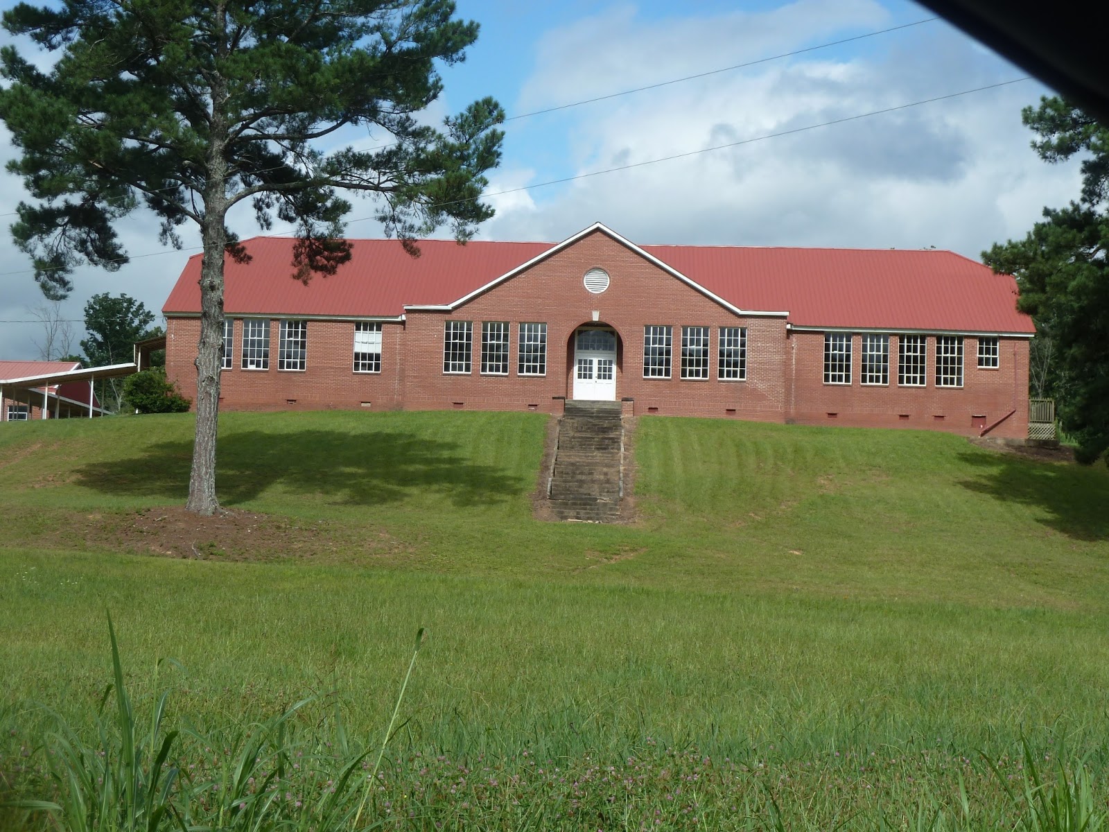
B - Today the old school is closed, but part of the building is now used as a community center.  The community center was donated to the community in memory of Kip Whittemore.  Through the years, several family members taught at this school.

C - Dan and Bessie Whittemore lived in this house for many years.  Today the house seems to be in good condition with a new family living there.


D - The Oakman-Ranger United Methodist Church was founded in 1870.  The original wooden church was located between the site of the present church and the church cemetery.

Oakman Methodist Cemetery
E - The Oakman Methodist Cemetery is next to the site of the original church building.  There are a number of Padgett and Whittemore relatives buried in the family plots of this small cemetery.

F - Today the house where Uncle Will and Aunt Willie Whittemore used to live is vacant.  The old barn on the farm still stands just south of the house.

One thing I liked about using Map Engine Lite was the ability to add points of interest to a map along with labels and descriptions.  Currently there is not the ability to also add photos to a map, but perhaps that will be available before too long.  I can also choose to make my map private or to share with specific individuals or even with the world.  I chose to make this map private, but when I share it with family members, they can read an extended description, additional information, stories, GPS locations if they click on any labeled point.  Pretty neat way to share family history!

Monday, June 17, 2013

Mappy Monday - Mapping With Google Course

https://mapping.withgoogle.com/course
Thanks to a link in Julie Cahill Tarr's Friday Finds, I learned about the free Mapping With Google course currently available online through June 24.  First I read the post in The We Tree Genealogy Blog to learn more about the course then went to the Mapping With Google web site to register.  Sure, I've used both Google Maps and Google Earth as genealogy resources before, but I was excited to learn more about how to create and customize maps that could then be shared with others.

The self-paced course covers using both Google Maps and Google Earth.  Once I registered for the course, I spend the next hour or so working on three parts of the five modules.  Most modules have a short video, the chance to apply what you learned while looking at sample maps, then completing your own map.  As I've worked on the modules, I've been taking notes in Evernote so I can still refer to them later on if I need to.

Two notes - Some of the activities require an invite to use the new Google Maps.  As soon as I receive my invite, I'll go back and complete the parts I've had to skip in the Google Maps activities.  Also, a number of people, myself included, continue to have issues importing the provided spreadsheets with GPS locations into our maps. The course staff continues to work on this problem.  Even with these two issues, I have already learned a lot.

Beside watching the videos on a topic, doing the self-check activities, studying sample maps, and making a simple map, you are also encouraged to complete a Google Maps project and a Google Earth project.  You then can evaluate them as to the features included and user-friendliness of each project.  Now I'm actually hoping for some rainy days this week so that I can try to complete my two projects.

My first map shows activities in the area to check out the next time we have the grandchildren up for a visit.  This way I can share it with them and let them pick out some of the things they want to do while here.  

As I'm learning more about customizing my map by adding colored or shaped icons, web links, photos, categories, and descriptions, I'm also getting exciting about ways I want to use these techniques to create and share family history information.  The first genealogy map I want to make will show family residences for my family and my husband's over a span of years.  Both families had lived for years in Cherokee County, Georgia, and I've been researching both families long enough to feel sure that they must have bumped into each other in town over the years.  It will have color coded icons to indicate the family tree of the resident and shades of color to represent the time period of residence.  Can't wait to get working on this.  Then I want to do several family migration maps incorporating photos of people and houses as my family had relatives moving around the country.  And then ...

You can learn the details of the course and register for it here.  Just remember to do this before June 24.